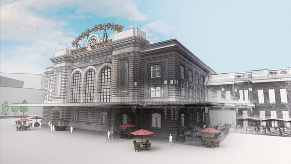
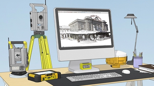
High-Quality 3D Scanning: Advanced 3D scanning capabilities, allowing users to capture high-resolution and accurate scans of physical environments, structures, or objects.
Efficient Data Capture: The software may streamline the process of capturing spatial data, reducing the time and effort required for surveying or creating detailed 3D models.
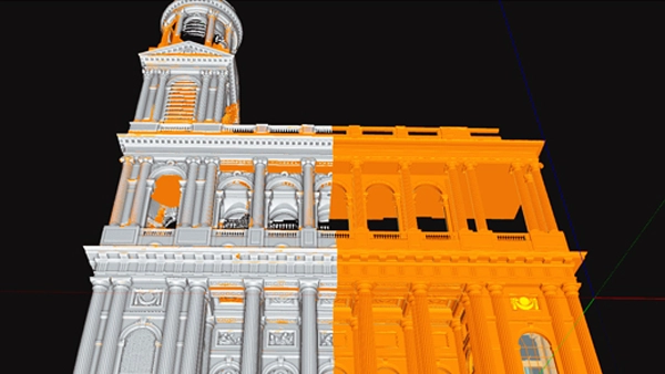
Point Cloud Processing: Tools for processing and managing point cloud data. Point clouds are collections of data points in 3D space, often generated by 3D scanners, and they serve as the foundation for creating detailed models.
Integration with Other Tools: It’s common for scanning software to integrate with other Trimble or third-party software tools, facilitating a more comprehensive workflow for users involved in geospatial and surveying tasks.
Visualisation and Analysis: Visualisation tools that allow users to explore and analyse 3D models or point cloud data. This can be crucial for making informed decisions based on the captured information.
Data Accuracy and Precision: Trimble is known for providing precise and accurate positioning solutions. Trimble’s expertise ensures high levels of accuracy in 3D scanning and surveying applications.
User-Friendly Interface: A user-friendly interface can enhance the overall user experience, making it easier for professionals in various industries to adopt and use the software effectively.
Compatibility and Scalability: Works seamlessly with other Trimble products and may be scalable to accommodate different project sizes and complexities.


